Australia is experiencing a weather crisis of rare intensity, poised to record one of the wettest Marches in its history under the onslaught of a relentless double monsoon.
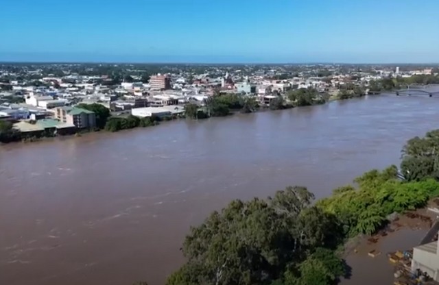
After a week of record rainfall that submerged Queensland and the Northern Territory, concerns are now focused on a dangerous tropical depression stationary on the border of the Kimberley region.
 NASA satellite images reveal a striking contrast: while the north is experiencing torrential rains, floodwaters are inexorably advancing southward in the Channel Country, following the banks of the Georgina and Diamantina rivers.
The Bureau of Meteorology (BoM) forecasts that the western half of the Northern Territory and adjacent areas of Western Australia will receive between 50 and 100 mm of rain over the next four days, with isolated peaks of up to 200 mm.
 This system threatens to dump the equivalent of several months’ worth of rainfall in just 48 hours, exacerbating an already critical situation where many waterways have reached major flood levels since the beginning of the month.
While lead meteorologist Angus Hines anticipates a relative decrease in water levels in disaster-stricken areas like Katherine, he warns that instability will persist with lingering showers.
Although these upcoming rains are less intense than the initial episodes, they will maintain extreme pressure on saturated soils and relief infrastructure, confirming the country’s vulnerability to these extreme tropical events at the start of 2026.